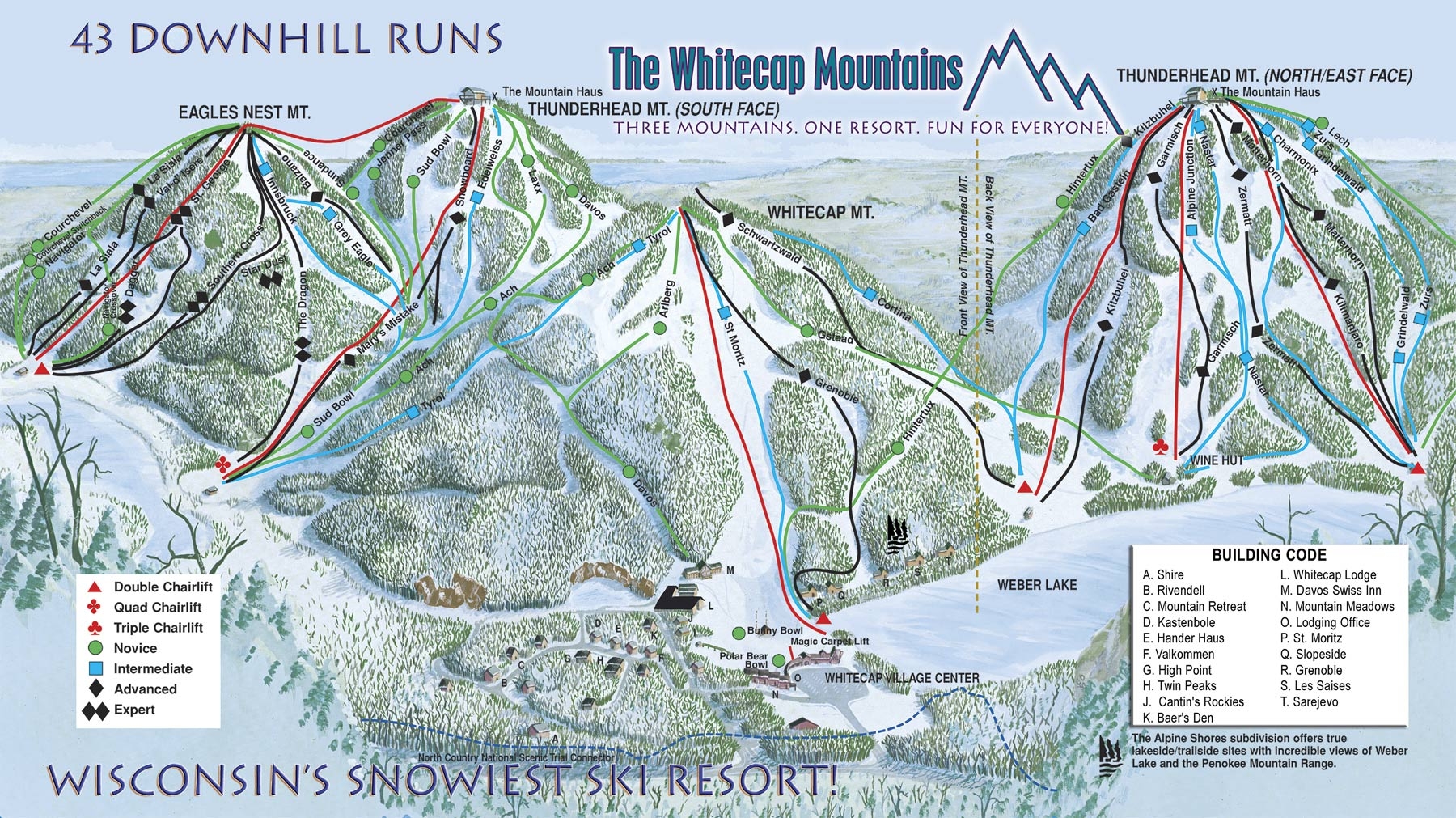
conrad Just noticed it: https://static.wixstatic.com/media/c45c70_c5c7324ce2654c9d8d03fb09a4dfce73~mv2.jpg/v1/fill/w_1920,h_960,al_c,q_85/2021%20Trail%20Map.webp
ILOVE2SKI Cool map! Dire Gamble and Vabroom are new since I’ve last been there. How are they? Also, anyone know why they dropped the name Davis and changed it to Twilight? At least Davis has a large history in the area, including the original J-Bar as shovel handle?
riverc0il Not sure it is much of an improvement. The image being so wide does the mountain no favors. It exacerbates how short some of its best sections are. The graphics are a step up, overall. But from a navigational perspective, it looks like there are fewer trees between the trails than there really are and the trails are hard to distinguish, everything kind of blends together.
ILOVE2SKI riverc0il;c-53492 wroteNot sure it is much of an improvement. The image being so wide does the mountain no favors. It exacerbates how short some of its best sections are. The graphics are a step up, overall. But from a navigational perspective, it looks like there are fewer trees between the trails than there really are and the trails are hard to distinguish, everything kind of blends together. This map does a better job showing some of those sections you mention: https://skimap.org/data/348/4196/1632537081.jpg
ciscokid Look at the HUGE improvement in this , I golfed there and didn’t have a clue where the ski trails went
ciscokid They even changed the new one when they decided you couldn’t ride the long chair over the big drop( after 50 years) I guess the chair is no longer the “ most bizzare chairlift in North America “ The interactive new one is cool too https://whitecapresort.com/winter/trail-map-snow-report